Wednesday, December 17, 2014

VES Global 50-Day Challenge Ride

Start 2015 off with an epic 50-Day ride! Bike at least 1 hour a day for 50 consecutive days. Ride outside or indoor. Do a 1 hour ride, two 30-minute rides, whatever ... just spend at least 1 hour total per day on a bike starting January 1 and finishing February 19.

To participate simply join the Facebok Event www.facebook.com/events/1406570152918208.

Please share this event. Get your friends to join you on this adventure and ride together as often as you can.

Success Parties will be held worldwide at various locations on the night of Friday February 21st! Party dates and locations will be posted here and on the Facebook Event as they're announced.

Community Sponsors
Awesome bike shops helping cyclists in their communities participate in the VES Global 50-Day Ride Challenge. [Click here to become a community sponsor.]
Shreveport, Louisiana
Charlottesville, Virginia


Fayetteville, West Virginia


The Rule: Ride a bicycle at least 1-hour a day for 50 Consecutive Days from Jan 1 through Feb 19.


To get the most fun, benefit and sense of accomplishment out of the VES Global 50-Day Ride Challenge really try to adhere to “The Rule”. This is about overcoming the challenges and experiencing the joys and adventures of riding every day.

“Mama T” 30 minute Option: If you’re not able to carve out a full hour a day, Mama T can still get you biking! Just ride at least 30 minutes per day for 50 consecutive days. You can do this!


If riding all 50 days is not possible, then ride as many days as you reasonably and safely can, and see the following FAQs:


Frequently Asked Questions:


“Can I ride on a stationary trainer? Rollers? Spin class? The exercise bike at the hotel?
Yes. Yes. Yes. Yes. Riding outside is the most fun, and super highly recommended, but all types of outdoor and indoor bicycle riding are allowable.


“Can I ride for 2 hours the next day to make up for a missed day?”
This challenge is for you. The idea is to experience the joy and benefits of daily cycling. Try not to miss, but if you do, the most important thing is to get on the bike again the day after you miss. Don’t let missing one day derail you!


“If I’m not feeling well can I skip a day, or two?”
If you’re not feeling well try this prescription: Ride a bicycle for 1 hour, drink lots of fluids, eat plenty of vegetables, spend time with people that love you and get a good nights sleep. If that doesn’t work, try doubling the dosage. (While meant as a joke, that prescription is actually alarmingly effective. If you’re not feeling well, use your best judgement and consult a doctor to determine whether riding is in the best interest of your health.)


“I just heard about / discovered the VES Global 50-Day Ride Challenge, but it started XX days ago - can I still join?”
YES! Just add the number of days you missed to the end of the challenge. So if you missed the first 5 days, then for you the challenge will end on 2/24 instead of 2/19.


“What happens at the end of the VES Global 50-Day Ride Challenge?”

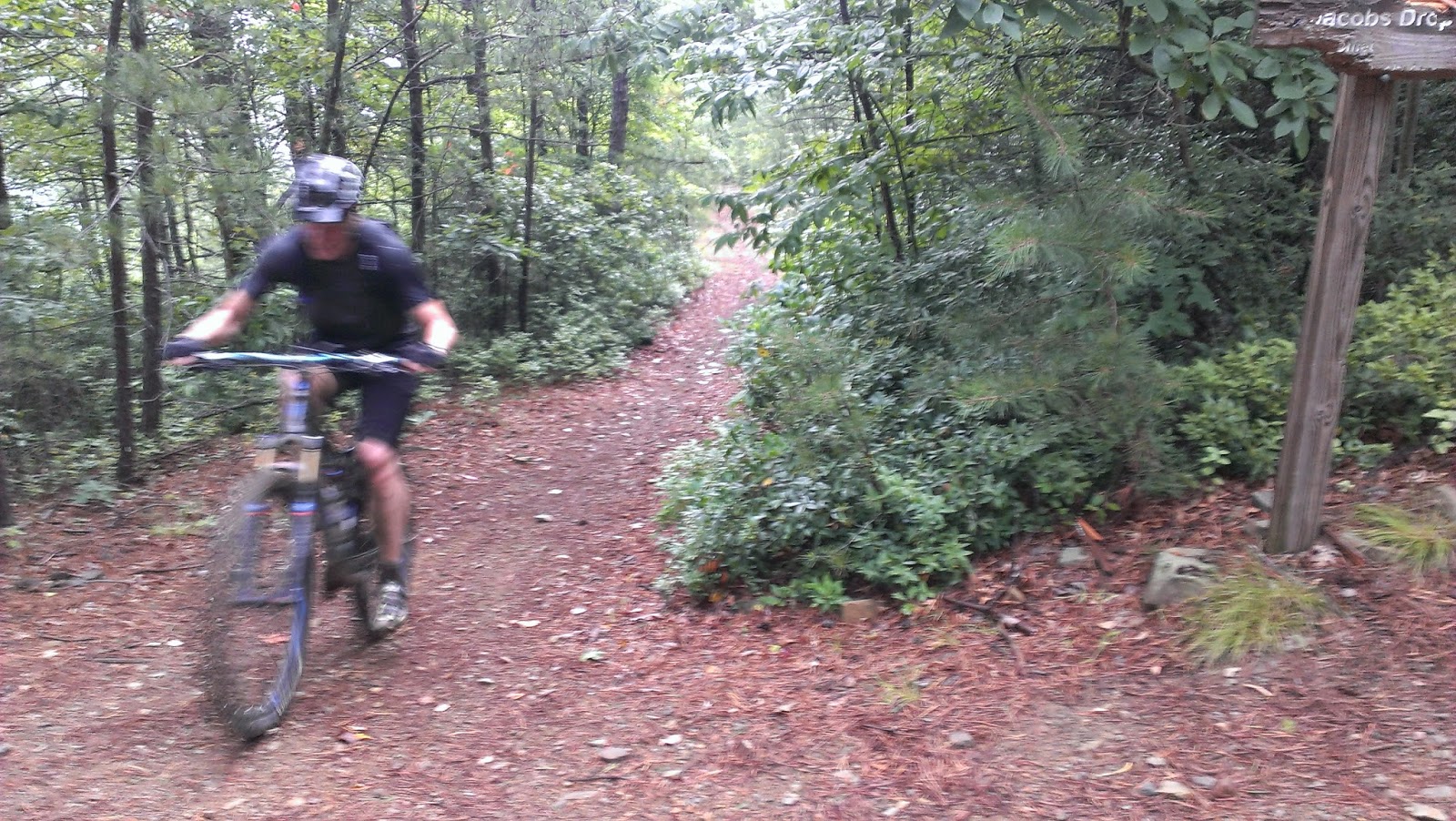
On February 19th most participants will be happier, stronger, more fit and physically, emotionally and mentally healthier than they were before the start of the challenge. By accepting this challenge you’re giving yourself an incredible gift ... making a commitment to do something that’s fantastic for you! Your being happier and healthier makes the world a better place for everyone your life touches. Our hope for you after the 50-Day Challenge? We hope you keep riding and inspire others to join you! If backcountry adventure mountain biking is your thing - join us for one of the other 13 FREE events in the Virginia Endurance Series www.virginiaenduranceseries.com

Monday, November 10, 2014

12.14.14 Hoop Hole + Patterson Creek VES Series Finale | FREE Event #15 in the Virginia Endurance Series

  • 8am Enduro Pace 46 miles
  • 9am Fast "Get'r Done" Pace 46 miles
  • 10am Party Pace 11 to 18 miles
All three will conclude at or before 4:15pm so we can all make it to ...

5pm Dinner + Beer at the Town Center Tap House, 90 Town Center St Suite 100, Daleville, VA 24083 http://goo.gl/maps/tDB6G

10am Party Pace 11-18 miles 
Price + Patterson Route & RIMBA Rolling Open BOD Meeting

10am Start from the South Patterson Mountain Trailhead http://goo.gl/maps/89Lrz | Directions
Map: Patterson Creek Trail System MAP PDF
[Route Length Option Examples: 11.3 mile Sulfur Ridge + Price Mt + Kelly Tr Overview Map | 14.9 mile Sulfur Ridge + Price Mt + Patterson Creek Rd Overview Map | 17.8 mile Sulfur Ridge + Price Mt + Patterson Mt Tr Overview Map]
Ride Leaders: Steve Johnson & Jeff Busche
Description: A phenomenal backcountry mtb adventure ride at a friendly comfortable no-rider-left-behind pace. Trail clearing and improvements within the Patterson Creek Trail System have been a sponsored project of the Roanoke IMBA Chapter and local trail superhero Stephen Johnson. The RIMBA Board of Directors will be among those attending this ride and having an informal open rolling board meeting!
10-20 Mile Price + Patterson Ride Start Location
8am Enduro Pace & 9am Fast "Get'r Done" Pace 46 miles
Roaring Run + Hoop Hole + Patterson + Price Epic
(This 46 mile route has loads of bail out options!)
8am = Enduro Pace Group (solid, steady pace, brief stops / regroups) Leader: Rob Issem
9am = Fast "Get'r Done" Pace Leader: Mark Smith smittymobile@gmail.com 

Description: Gorgeous and very challenging backcountry adventure mtb ride. This route (combining the Roaring Run / Hoop Hole and Patterson / Price trail systems) has never been attempted before. Pioneering this route will be an incredible finale to a fantastic season of VES rides!

Start from the parking lot on Craig Creek Rd / 615 just off 220 http://goo.gl/maps/MyAIC
1-246 Craig Creek Rd, Eagle Rock, VA 24085

Maps: Full Route Map + Cue Sheet PDF (designed to be 11x17 color printed).
Area Maps: Roaring Run / Hoop Hole: MAP PDF | Patterson Creek Trail System: MAP PDF | TI #788 http://www.natgeomaps.com/ti_788

46 mile ride start location: 1-246 Craig Creek Rd, Eagle Rock, VA 24085


Some will attempt the whole 46 mile adventure, others will enjoy one of the many fantastic shorter options ... the key is to be back to the parking area by no later than 4:15pm so we're all eating and drinking beers at the Town Center Tap House by 5pm!


Patterson Creek Trail System: MAP PDF


Roaring Run / Hoop Hole: MAP PDF

Roaring Run + Hoop Hole + Patterson + Price (46 miles)


Even more details coming soon ...


Thursday, October 30, 2014

11.2.14 Torture on Torry Ridge | FREE Event #11 in Virginia's Mountain Biking Endurance Series

What is the Virginia Endurance Series?
Start Time: 9am, Sunday November 2, 2014
Start Location: Sherando Lake
Start Location Map / Directions: http://goo.gl/maps/OCK30


FOLDER containing all Full Resolution Route Images: LINK
Drawn GPX File: LINK
Distance: ~41 miles
Climbing: ~7,100 feet

Route Overview: Courtesy of Bill Hazlegrove of the Hazlegrove Agency www.hazlegroveagency.com
For a high-resolution JPG and an easy printing PDF CLICK HERE

Cue Sheet: (Thank you Mark Smith!)
1. From parking lot at the back of Sherando lake camp ground near upper lake dam, take a right at gate to field.

2. Follow Slacks Run trail all the way up to a right on Torry Ridge.  There will be a couple lefts along the way. If you take either of these by accident, you’ll end up in a parking lot along the Parkway.

3. Ride Torry Ridge ~4.5 miles then descend taking a left (~9.7 miles into the ride).  Very steep and narrow here.  At the bottom of the descent there is a no-name trail to the right, stay left through a dry creek with a steep climb out.  Fun little section with some small jumps.

Bailout option: If you take a right at the top to “Torry Furnace”, you can take the paved road route 664 back to Sherando lake. 
4. After crossing a small creek, take a left in the “vehicle turn around” onto Mill Creek / Turkey Pen Ridge.  Follow this trail all the way to the top of the mountain.  The local challenge is to make the switch back climb all the way up without stopping or clicking out of your pedals. The last 100 yards to the camp spot are the hardest.  Good luck.

Bailout option: turn left onto jeep road and follow direction from line 7 below
5. Turn right and follow the jeep road for ~3-3.5 miles and turn right onto Kennedy Ridge trail.  This trail starts out with some fun rock sections then a fast descent to the coal road.

Bailout option: Turn right and follow coal road all the way back to route 664
6. Turn left on the coal road.  After ~3 miles yield left onto jeep road.  You will climb for ~5-5.5 miles on the jeep road (stay on switch backs).  You will pass by the Kennedy Ridge trail head again in the opposite direction.

7. Just past the camping spot at the top of Mill Creek / Turkey Pen Ridge trail on the jeep road, you will yield left off the main jeep road.  Less than a couple hundred yards up this dirt road, turn left on Torry Ridge trail.  Along this section of Torry Ridge is a very challenging rock section.  Please be careful!

Just over a mile down Torry Ridge, take a left back onto Slacks Run.  Follow this back to car.

Route Details:
Miles 0 to 7:
Miles 7 to 14:
Miles 13 to 20:
Miles 20 to 31:
Miles 31 to End:


Sunday, October 12, 2014

The Iron Forge | Virginia Endurance Series and RIMBA Local Destination Ride

Two 19th Century Blast Furnaces, Two Mythic Backcountry Rides, Two Historic Counties, One Epic Day: Sunday, October 19th, 2014.

Stage One | 9AM | Roaring Run Furnace.
Start Location: http://goo.gl/maps/QQK2C
Distance: 12 miles

Stage Two | 1:30PM | Longdale Furnace
Start Location: http://goo.gl/maps/NxAeb
Distance: 16 miles
Roaring Run Furnace
Longdale Furnace
Stage One: Roaring Run Furnace.
Location: Roaring Run Furnace Recreation area parking lot. Note that parking is limited. Overflow along the roadside. Take 615 off 220 (Eagle Rock) for 6 miles, then right on 621. Go 1 mile to sign and recreation area on left.  http://bit.ly/1B3pNH9
Ride Starts: 9AM.
Distance: 12 miles.
Description: The ride leaves the rec area parking lot for a 1 mile prologue that takes us to the Roaring Run blast furnace that produced pig iron in the 1800’s, some of which was used for Civil War munitions. It stands like a stone pyramid, and it gorged itself on trees, stripping the area barren in those days. Thank goodness for Mother Nature’s superior healing abilities. Then, the singletrack winds its way to then namesake Roaring Run Falls, gorgeous and most impressive following a stout rain. A quick return past the parking area leads us to the Iron Ore Trail, a solid 3 mile ore grade climb up the flank of Rich Patch mountain. Once up, we take the lower Hoop Hole Trail for an astonishing and beautiful decent, with wild rarely used Allegheny trail lined with rhododendron and and laurel, with several creek crossings. After the eventful decent, we emerge at the Hoop Hole trailhead before descending by road on 615 to 621 and a return to the start.
Transfer: 30 Minute Drive
It’s 24 miles between stages. Lunch and supplies can be found at Kelley’s Market on 220.

Take a right out of Roaring Run Recreation area onto 621. Go one mile, then left on 615 back to US 220. take a left (north) on 220. Go just over 10 miles, then right just prior to the bridge leading before the town of Iron Gate, on McKinney Hollow Rd. Follow McKinney Hollow (it has some twists and turns, just stay on McKinney Hollow and you’re good) winding your way to Longdale Furnace road. Take a right (east) going almost 4 miles to Longdale Furnace Recreation Area on right. The dirt road has a right fork a short ways in, take the right. If the gate is open, parking is ahead through gate. If not, pick any spot you like.


The way through Pete's Cave


Stage Two: Longdale Furnace.
Location: Longdale Furnace Recreation area parking lot. Note that parking is limited. Overflow along the roadside.
Ride Starts: 1:30PM.
Distance: 16 miles (more available).
Singletracks.com: http://bit.ly/1x7HBmY Ride varies slightly from this outline.
Downloadable, high quality map of the loop. Ideally, 11X17 printed: Longdale 16 Loop Map
Description: The Longdale/North Mountain loop packs tremendous variety and excellence in a compact package. From the site of an 1800’s blast furnace named Lucy Selina, you’ll encounter: forest road, long dirt climb, sweet Allegheny ridgetrail, amazing views, unusual rock formations, challenging sidehill descent, and a long closed National Forest swimming lake. The ride rises through the rec area to a rolling 3 mile forest road climb. At a junction of the North Mountain trail, bear left across creek continuing on the forest road, arriving at a National Forest parking area with kiosk. Out of the parking lot, take a right up Collierstown Road for a dirt climb of 3 miles, rising over 1000,’ to the North Mountain ridge. At the intersection near a radio tower, take a right dropping down road slightly to reveal a trail, up sharply on the right. The next half mile of the North Mountain trail reveals stunning views across Rockbridge County to the east, and beyond. Stop and enjoy several viewpoints before the trail hits the hardwoods. In just over 3 miles of generally climbing singletrack, a steep hike and narrow crevasse called Pete’s Cave provides a one-of-a-kind experience. Once through, right at the top, walk right onto the boulder overlook. To the northwest is a canvas of massive views of I-64 and the Alleghenies off in the far distance towards West Virginia. Continue on trail until we drop off the ridge at a trail sign (right). The drop is classic, through a deep V hollow with several swaps from side-to-side. The trail ends at the forest road junction passed earlier, exiting the way we approached.

There are options here to extend the adventure, or, duck downhill on the dirt road to a cold refreshment waiting.

Driving Directions: Roaring Run Furnace, Kelley's Market, Longdale Furnace


Tuesday, August 12, 2014

5.29.15 "Everesting" of Mill Mountain

VES Mill Mountain Everesting Attempt

What is Everesting? http://www.everesting.cc/

The elevation of Mt. Everest is 29,029 ft. Each lap up Mill Mountain's Old Road is 807 ft. Do this 36 times and you've just rode up Mt. Everest!

This Strava Segment shows the route we plan to take.

Each lap is 3.88 miles round trip so 36 laps will come to about 140 miles…but hey half of that you'll be coasting!

Attempt Date: Friday May 29th 12:01am. Start time can vary for whatever makes the most sense for you and your goals for the day. Anticipate each lap will take 25-35 minutes plus breaks.

No one from Virginia has ever Everested a climb. Only 5 riders in the entire US have Everested. 149 worldwide. http://www.everesting.cc/hall-of-fame/ If you feel you can pull off 36 laps and want to be included in the Hall of Fame, be sure to read their rules. http://www.eversting.cc/the-rules

36 laps is crazy you say?! Don't despair only a select few elite athletes will be able to accomplish this amazing feat. But how many can you do? Just as mountaineers test their abilities and find the highest mountain to match their skills, you can do the same. That's why we are also setting several attainable mountains you can set your sights on.

The Frump Frump - 1 Lap
The Alpe d'Huez (climb equivalent)- 5 Laps
Mt. Rogers - 8 Laps
Machu Picchu - 10 Laps
The Alto de Letras (climb equivalent) - 13 Laps
Half Everesting - 18 Laps
Mont Blonc - 20 Laps
Denali - 26 Laps
Death Zone - 33 Laps
Everesting - 36 Laps

Set your goals and then exceed them!

This event is FREE! However, RSVP if possible so we can plan accordingly. Each rider will have their own paper pull tabs at the summit with information about each lap and to help celebrate each amazing accomplishment attained.

If you plan on Everesting you must use a barometric GPS to track your ride and it must be uploaded to Strava. You must also come down the same route you are going up and no changing the route as soon as you begin. I cannot stress the importance of reading the rules set by the Hells 500 group.  If you do not plan on Everesting, then you may descend the New Road if you like because we honestly don't care.

As you enter your 12th lap there will be a mountaineering role play which will help you feel as if you too are climbing Everest. Each lap you will learn about the struggles and milestones of a real climber hiking towards base camp, camps I through IV and entering the Death Zone. By the end of the day you will have a greater sense of how big this mountain, and other mountains, really are because you will have rode them all!

Food and drinks may be stored at Underdog Bike (aka Base Camp) during their operating hours. Hopefully we can keep a cooler for food and drinks at the summit as well if someone is willing to watch over it. You are responsible for bringing your own food. If you bring extra food and decide to share it, we will have a table for 'pot luck' food.

There will be a group photo at the Star at 9 am. Anyone taking pictures with Instagram is encouraged to use the hashtag #Everesting to help the Hells 500 organizers follow our progress.

The picture below provides proof directly from the City Engineering Department that the elevation at Underdog is 930 ft. and the elevation at the Star viewing platform is 1737 ft.


Saturday, August 9, 2014

Star City Vicious Randonnee is 100% definitely happening!!!

For anyone unfamiliar with the Virginia Endurance Series - yes, we are 100% definitely riding tomorrow 8/10 9am.

www.viciousrandonnee.com

Some will ride the complete Suiride route (all 115+ miles and 15,000+ feet of climbing), yes regardless of the weather conditions ... and yes it will absolutely be a good time.

Of all the hundreds or thousands of rides you've done in your life, if you participate in the Star City Vicious Randonnee you will very distinctly remember it. Guaranteed.

Tuesday, August 5, 2014

8.10.14 Star City Vicious Randonnee "Any road cycling." 6 mettle testing routes from 12 up to 115 miles!


8.10.2014 - Any road cycling.

Once a year cyclists have a chance to get their name added to the short list riders who've completed "The toughest group road ride in the history of Virginia" ... the Suiride route of the Star City Vicious Randonnée.

Climbing, adventure, dirt road climbing, astonishingly beautiful terrain ... and it's FREE!

There are 6 route options, and whether you're making history by attempting the Suiride, or enjoying the Vicious, Gran, Medio, Challenge or Prologue routes ... you are in for an incredibly beautiful and physically challenging experience. CLICK HERE FOR DETAILED ROUTE INFORMATION


https://www.facebook.com/events/225562687595244


Arrive at 8:30am, all rides start promptly 9am from the East Coasters Bike Shop, 3224 Brambleton Ave, Roanoke, VA 24018. 540.774.7933

Unsupported.

Cue sheets will be provided.

*FREE* To enter simply "Join" the facebook event: www.tinyurl.com/starcityvicious

Ride at your own risk.

Randonneuring is long-distance unsupported endurance cycling. A randonnée is an organized group ride, with some emphasis on speed, but it is not a race, and self-sufficiency is paramount. When riders participate in randonneuring events, they are part of a long tradition that goes back to the beginning of the sport of cycling in France and Italy. Friendly camaraderie is the hallmark of randonneuring.

)

The 15 rated climbs of the Suiride route:


SUIRIDE Route - 115.0 miles / 15233 feet - CLICK HERE FOR CUE SHEET


Refuel Points at miles 28.8, 44.8, 65.1, 84.5, 90.7, 99.9.


VICIOUS Route - 95.9miles / 12389 feet - CLICK HERE FOR CUE SHEET


Refuel Points at miles 28.8, 44.8, 65.1, 84.5.


GRAN Route - 68.9 miles / 8858 feet - CLICK HERE FOR CUE SHEET


Refuel Points at miles 28.8, 44.8, 65.1.


MEDIO Route - 38.0 miles / 5292 feet - CLICK HERE FOR CUE SHEET


Refuel Point at mile 29.1.


CHALLENGE Route - 24.8 miles / 3251 feet - CLICK HERE FOR CUE SHEET


PROLOGUE Route - 12.4 miles / 1372 feet - CLICK HERE FOR CUE SHEET


Monday, July 28, 2014

From a brutal slugfest a new elite cyclist emerges ...

Luckily, I was right place at the right time to witness an incredible athletic performance yesterday.

He didn't realize he was in over his head, much less how far in over his head he was ... but that didn't matter. In his mind he had distilled this situation down to a simple conviction "no matter what lie ahead, he would not deviate from the course and he would not give up". Period.

Viscerally, this was more like a 15 round boxing match than an epic mountain bike challenge ride. By round 7 Ricci had already been hurtled to the ground by the Gamut a couple of times, though there wasn't even a hint of submission. Time and again Ricci picked himself and his bike up and the battle would wage on.

Back pain and enormous fatigue were factors for Ricci by round 11 when the Gamut relentlessly pounded Ricci with the Kerncliff climb. Still, I was not surprised when Ricci, steadily walking beside his Rumblefish, crested the summit. Round 11 - Ricci.

Round 14 was Hemlock Tunnel end to end. I didn't realize it but rocks hidden beneath leaves had thrown Ricci to the unforgiving trail. I waited and waited for him at the bottom of the descent. I called out to him, but no response. Then, just as I was about to head back up, the distant sound of tire disturbing rocks could be heard. Moments later Ricci rolled up to my rear wheel with a few new scrapes. Clearly battered, Ricci somehow made it to the end of Hemlock Tunnel, but he had nothing left. His bike fell to the ground, Ricci dropped to his knees and elbows, he was now out of water too ... and the bell sounded. Round 14 - the Gamut.

Anyone watching this would have bet against Ricci even emerging from his corner to contest the final round, but rise he did.

Ricci, for the first times, spoke aloud about not being able to continue, but uttering those words seemed to free him of them. As Ricci battled along 4 Gorges it was now the Gamut who was beginning to submit to the impossible resolve of Ricci.

With a final acceleration, Ricci ascended the rocky entrance to the Bennett Springs Parking area. There were no reporters, no fans, not even a visible finish line, though the challenge and challenger both knew what had just gone down.

Everyone that showed up to this year's annual challenge of "The Gamut" (riding every trail at Carvins Cove in a single day) likely loaded their cars in the rain to drive to the start. 23 began their Gamut attempt at the designated 9am start time and a number of others started later. Of these very hearty souls, only 6 would complete the entire Gamut route 43.1 miles, 7,231 feet of climbing.
  • Jeff Cheng
  • Sean Mallahan
  • Ryan Fedak
  • Matt Childers
  • Shawn Ricci
  • Rob Issem
Personally, it took me 7 attempts before I completed my first full VES route in November of 2013. There are shorter options for every VES event, but the full (longest) route is intended to be challenging even for Virginia's top endurance athletes.

Welcome to the endurance cycling elite Shawn Ricci.
... and the winner is ...
Studies have conclusively determined that excruciating leg cramp pain
always subsides after a picture has been taken and posted to Facebook.

Friday, July 25, 2014

7.27.14 "The Gamut" (Ride Every Trail at Carvins Cove) | FREE Event #8 in Virginia's MTB Endurance Series

When: 9am Sunday July 27th
Where: Carvins Cove - Bennet Springs Parking Area http://goo.gl/maps/6KASO

PDF Map & Route Guide 
v2013 GPX FILE
v2014 Additions GPX FILE
How to Navigate with GPX Files
What is the Virginia Endurance Series? LINK

Roanoke is the "2013 Best Trail Town" http://www.blueridgeoutdoors.com/hiking/best-trail-town-2013-roanoke-virginia/ for one reason ... the singletrack at Carvin's Cove.

Download & Print: PDF Map & Route Guide 
http://is.gd/e4bjzf (11"x17" recommended)

With the sweet trail offerings continuing to expand, riding "The Gamut" at Carvins Cove (every trail in the extensive singletrack system in a single day) has become quite a challenge: 43+ miles with LOTS of climbing.

The absolutely incredible trails, and the corresponding high most mountain bikers experience while riding them, keeps the accomplishment of riding "The Gamut" seemingly within reach (though very few have people have actually done it).

The Gamut consists of 2 stages (see above map). Both stages start and end at the Bennett Springs parking area, which is perfect for refueling and restocking mid-point in the Gamut attempt. Both stages contain numerous bail out options too.

On Sunday July 27th we will meet at the Bennett Springs Parking Area http://goo.gl/maps/6KASO for the 9am start of VES #8 an attempt at riding "The Gamut".

CARVINS COVE "GAMUT" v2013 GPX FILE
 
CARVINS COVE "GAMUT" 2014 TRAIL ADDITIONS GPX FILE
Gamut v2014 adds the BRG Gauntlet Jump Line, Lakeside Trail, lower Hemlock Tunnel and the section of Kerncliff between Comet and Jacob's Drop. 


Wednesday, July 23, 2014

Endurance Gear Review: Trek Remedy 9 29er - Fun and safety maximized.


I'm regularly asked why I've chosen the Trek Remedy 9 29 for VES events and as my daily whip and the simple answer is that it's a mountain biking fun maximizer. Pinkbike concurs:

"I was a pretty big fan of Trek's aluminum Remedy 29er when I reviewed it back in September of last year, with the bike surprising me with just how capable it is. Such was the chrome machine's adeptness that I didn't hesitate to put in 70km death marches with 9,000ft of climbing on a Saturday before heading to Whistler on Sunday. Sure, it wasn't the best at either task, and it isn't intended to be, but I can honestly say that it might have been the most fun for both jobs. You can't say that about many bikes, can you?"

The other very important aspect for me is that I do *not* like crashes & injuries. I'm closing in on 45, so I
don't recover from injuries as quickly as I used to, but I still enjoy riding technical backcountry gnar. The more slack angles of the Remedy (67.5° head angle) combined with it's 140mm of dialed-in travel result in a bike that helps keeps me out of trouble ... and the Remedy often saves me when I inadvertently ride myself into a situation beyond my skill set.


While the Remedy 29 is not a climbing KOM killer it is a very capable and comfortable ascender. Leave the rear suspension in Trail mode and climbing traction and stability are incredible. You'll find yourself riding technical trail climbs that you've never cleaned before and you can comfortably climb and climb and climb ... staying on your bike more, pushing your bike less.

A truly unexpected and fantastic surprise for me was how well the Remedy 29 rides tight switchbacks - especially uphill. The bike turns back on itself with stability and control like no 29er I've ridden. 

The only subtle handling mod I made to my 21" Remedy 9 29 was swapping out the stock 750mm handlebar for a Spank Spike EVO 777 and in my opinion the slightly wider bar nicely compliments the Remedy's layout and handling. I opted for a white and black 777 but Spank makes a chrome and black version that would be a crazy perfect match for the bike's oem aesthetics (if you're into that).

Tire clearance is absolutely outstanding on the Remedy 29. When Schwalbe Nobby Nic 2.35s are mounted
to American Classic Wide Lightning rims (look for a full review of these wheels in the coming weeks) the casing width measures a massive 2.407 inches and the Remedy 29 easily accommodates these large aggressive tires with gobs of room to spare!


Since Trek's Remedy 29 introduction earlier this year, the rave reviews and its popularity speak volumes for the bike, but I highly recommend taking one for a test ride at your local dealer or during a Trek Factory Demo Day near you. 

Bottom Line: The Trek Remedy 29 enables people to ride longer with more comfort and ride technical terrain with more confidence and safety ... which conflates into very high levels of mountain biking fun!

For 2015 Trek is adding lighter carbon framed models to the Remedy 29 lineup. Click here for a preview from Pinkbike.

Wednesday, June 18, 2014

6.22.14 Big Schloss Epic | FREE Event #6 in Virginia's MTB Endurance Series


Full resolution PDF: http://is.gd/G32t0V
36.49 miles / 6596 feet of climbing

This incredible VES route features the northernmost section of the VA MTB Trail http://virginiamountainbiketrail.com/ and finishes with the legendary Big Schloss downhill.

Start Time: 9am

Start Location: Little Stoney Creek 571 Trailhead on Route 92 http://is.gd/2jEG7p

[Alternate Start Time / Location = 7:45am / Wolf Gap Campground. It's a 5 mile sweet singletrack ride from Wolf Gap to the official start location above. Map: https://www.dropbox.com/s/cvaprzqkt3ynv1i/camp_to_start.jpg]

GPX File:
2014 Drawn File: https://www.dropbox.com/s/8fazojlutxrj2d4/Big_Schloss_Epic_v2014_%28Drawn%29.gpx
(Note: this GPX includes the additional trail sections to and from the Wolf Gap campground. Drawn GPX files are not as accurate as actual GPX data files.)

2013 Route *DIFFERENT from 2014* Actual (Ridden) GPX:
Note: this actual 2013 GPX is a good navigational reference for portions of the 2014 route.
https://www.dropbox.com/s/p2923rxy2b78i88/BigSchloss_v2013_ridden.gpx
2013 Strava: http://www.strava.com/activities/957623062013 Route Description: https://www.dropbox.com/s/3plnado5l004783/VES%20%239_Big_Schloss_Map_11x17.pdf


CAMPING: Wolf Gap Campground. Campers wishing to pedal to the start from the Wolf Gap Campground simply ride up the 1004 Mill Mt Trail for 2.75miles to the 415 Big Schloss Cutoff DH and downhill to the ride start. Riders also have the option of taking the short spur trail to check out to Big Schloss proper 1004A! Info on Wolf Gap Campground: LINK

Critical Note: The Big Schloss Epic route is VERY challenging from start to finish. **Please come well prepared.** Bring a water filter, plenty of food, bring all gear needed for basic bicycle repairs and a first aid kit (minimally, something like this http://youtu.be/YIZLMouV3j4). In 2013 an exceptional group of more than 20 cyclists attempted a variation of this route, moving time was roughly 7 hours, elapsed time was 9 hours ... and it was an awesome day of epic backcountry adventure mountain biking!!


3 Shorter Options. All start and end at the same location:


Monday, May 5, 2014

6.21.15 SVBC Project Showcase - Lookout, Wolf & Narrowback | FREE Event #5 in the Virginia Endurance Series


PICTURES FROM THE 2014 RIDE
(If you have pictures to add to this DropBox folder please email robertissem@gmail.com and I'll add you as a contributor.)

Date: Sunday June 21, 2015
Start Time: 9am
Start Location: Wild Oak Trailhead Parking http://goo.gl/maps/bZXEM
PDF Map w Cue Sheet (ideally printed on 11x17 paper): LINK

Mark your calendars, this VES features 3 route length options (13, 30 & 43 miles) and some of the very best mountain biking anywhere!

Shenandoah Valley Bicycle Coalition (SVBC) continues to make a huge impact on trails all over the Harrisonburg, VA region and particularly in the George Washington National Forest. Through SVBC's model partnership with the USFS, some amazing results have been produced. SVBC's work in the North River District of GWNF is ongoing, with the club maintaining even the remotest of trails. Also, monetary contributions secured through the RTP and other sources have funded projects a grand scale and optimized the riding experience.

Great article on the riding in this region of VAVirginia's new mountain biking mecca | GrindTV.com


Support the Shenandoah Valley Bicycle Coaliton Recreational Trails Program! from Shenandoah Bicycle on Vimeo.

3 Length Options: All Start at the Wild Oak Trailhead Parking area.
Install the MTBProject APP on your Android or iPhone: LINK and download each of the above rides!

What does it do?
            • Complete maps, vertical profiles, descriptions, and photos for every Ride and Trail
            • Send a Ride or Trail to the phone, and it will be there next time you open the app
            • Sync your To-Do list & Check-Ins
            • Out on your ride, your location appears right on the trail - you will never get lost!
            • Works with no cell signal, including all mapping and geolocating features