Wednesday, November 27, 2013

12.15.13 Dragon's Back Full-Tour 31.4mi 7300ft | FREE Event #10 in Virginia's MTB Endurance Series


*Important Notice* This VES ride is being relocated! The trails at Carvins Cove would be a mess after all of this rain. The new meeting location is the Dragon's Tooth Trailhead http://goo.gl/maps/ZIE10 (same 9am start time). 


 There are LOTS of ride length options ranging from 11 to 40 miles. Below are just a couple of sample options. Everyone will start together and then riders can choose the route option that optimizes their fun once on the ridge!

PLEASE SPREAD THIS NEWS. (Note: We will reschedule the CC Gamut - but tomorrow would be a bad day to showcase / enjoy the great trails at Carvin's Cove).

Above is the route I will lead tomorrow: 31.4 miles, 7,300 feet (yes 7,300!)
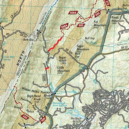
Full North Mountain Ridge Trail, Left onto FR183, Left onto FR224 Wildlife Rd, Left onto Turkey Trail (climb), Right onto North Mountain Trail, Right onto Grouse Trail (downhill), Left onto FR224 Wildlife Rd, Left onto Deer Trail (climb), Right onto North Mountain Trail - which is an amazing downhill right back to the parking.

Short but Sweeeeet Option:

30 Mile Option:

What is the Virginia Endurance Series? LINK

When: 9am Sunday December 15th
Where: Carvins Cove - Bennet Springs Parking Area http://goo.gl/maps/6KASO

Distance: Stage 1 = ~22miles, Stage 2 = ~18 miles, Full Gamut = ~40 miles ~6000 feet

Roanoke is the "2013 Best Trail Town" http://www.blueridgeoutdoors.com/hiking/best-trail-town-2013-roanoke-virginia/ for one reason ... the singletrack at Carvin's Cove.

Navigation:
Download & Print: PDF Map & Route Guide 
http://is.gd/aDK9rA (11"x17" recommended)

Download & Print: PDF Pocket Guide
http://is.gd/19cmpO (Design for 8.5"x11")

Lights: Any rider starting Stage 2 after 12:30pm should equip their bike with high-quality lights. Lights should be good enough so that you're able to have fun, ride fast, and be safe. Stage 2 is tough with numerous technical sections, and it includes the hardest climb in the Gamut. There are many bailout options, and if you feel like you're unable to continue to ride safely please take one of them. The Gamut is not going anywhere. If you can't safely complete it on 12/15/13 just keep training and come back and go for it another day.

With the sweet trail offerings continuing to expand, riding "The Gamut" at Carvins Cove (every trail in the extensive singletrack system in a single day) has become quite a challenge: 40+ miles with LOTS of climbing.

The absolutely incredible trails, and the corresponding high most mountain bikers experience while riding them, keeps the accomplishment of riding "The Gamut" seemingly within reach (though very few have people have actually done it).

On Sunday December 15th we will meet at the Bennett Springs Parking Area http://goo.gl/maps/6KASO for the 9am start of VES #10 an attempt at riding "The Gamut".

Loads of shorter options are possible, and a video preview of the "The Gamut" v2013 route is below:


Saturday, October 26, 2013

11.17.13 Big Schloss Epic | FREE Event #9 in Virginia's MTB Endurance Series

11.17.13 Big Schloss Epic FACEBOOK Event Page


35.15 miles / 6376 feet of climbing

This incredible new VES route features the northernmost section of the VA MTB Trail http://virginiamountainbiketrail.com/ and finishes with the legendary Big Schloss downhill.

Start Time: 9am
Start Location: Little Stoney Creek 571 Trailhead on Route 92 http://is.gd/2jEG7p
Driving Directions to the Ride Start: www.tinyurl.com/bigschloss
GPX File: LINK (Drawn course, not and actual ride GPX)


<< Click here to download the Map & Route Guide PDF, then print it on 11x17 paper. 


Extraordinary VES maps created by Bill Hazlegrove.
www.hazlegroveagency.com 


Cue Sheet: Big Schloss Epic | FREE Event #9 in Virginia's MTB Endurance Series
www.virginiaenduranceseries.com

Parking - Ride Start/Finish at the Little Stoney Creek 571 Trailhead on Route 92 http://is.gd/2jEG7p

0.00 From of the trailhead climb the Little Stoney Creek Trail 571 for 3.54 miles (climbs 1453’)

3.54 Right onto Tuscarora Three Ponds Trail 1013.1 for 0.92 miles (+103’ -393’)
4.46 Left onto Racer Camp Hollow Trail 1036 for 2.72 miles (+237’ -821’)
7.18 Left onto Old Mailpath Trail 1037 for 1.09 miles (+103’ -375’)
8.27 Right onto Wilson Cove Trail 1014 for 2.07 miles (+349’ -204’)
10.34 Left onto Vances Cove Trail 400 for 1.33 miles (+12’ -266’)
11.67 Continue on Vances Cove Trail 400 for 1.98 miles (+33’ -250’) *
13.65 Left onto Paddy Cove Lane for 0.10 to Vances Cove Road 93
13.75 Right on Vances Cove Road 93 for 0.27 miles to Gate
14.02 Gate - go straight around gate and continue on Vances Cove Road 93 for 0.13 miles
14.15 Left at T intersection 93 for 2.30 miles (+351’ -48’) to Gate
16.45 Gate - go straight around gate for 0.22 miles to T intersection
16.67 Left at T intersection (Cold Spring Gap Road) for 0.19 miles to 55
16.86 Left onto 55 for 0.78 miles (+275’ -34’)
17.64 Left onto Tuscarora County Line Trail 1013.3 [The beginning of the Virginia Mountain Bike Trail!] for 4.15 miles (+920’ -661’) to Gerhard Shelter and 902 Trail Intersection
21.79 Continue Straight on Tuscarora County Line Trail 1013.3 for 3.71 miles (+399 -1211)
25.50 Left onto 505 for 0.41 miles (+36’ -88’) to Gate
25.91 Gate - go straight around gate for 0.17 miles and look for Tuscarora Pond Run Trail 1013.2 on the right
26.08 Continue on the Tuscarora Pond Run Trail 1013.2 climbing for 4.11 miles (+1820’ -66’) to the summit of Mill Mountain where the trail becomes the Mill Mountain Trail 1004.
30.19 Continue on Mill Mountain Trail 1004 for 2.68 miles (+148’ -703’)
32.87 Left onto Big Schloss Cutoff 415 and downhill 1.73 miles (+16’ -1117’)
34.60 Left onto Little Stony Road for 0.54 miles (+5’ -86’)
35.14 Parking - Ride Start / Finish 
* If at mile 11.67 Vances Cove Trail is in too rough shape to enjoy, then ...
11.67 OPTION B Left onto fire road for 0.10 mile to Vances Cove Road 93
11.77 Right onto Vances Cove Road 93 for 2.32 miles (+242’ -430’)
14.09 Paddy Cove Lane on right - continue straight to Gate


Saturday, September 21, 2013

10.20.13 Torture on Torry Ridge | FREE Event #8 in Virginia's Mountain Biking Endurance Series

What a phenomenal ride!! This short video only captures 1/1267th of the awesomeness!

What is the Virginia Endurance Series?
Start Time: 9am, Sunday October 20th
Start Location: Sherando Lake
Start Location Map / Directions: http://goo.gl/maps/OCK30
FOLDER containing all Full Resolution Route Images: LINK
Drawn GPX File: LINK
Distance: ~41 miles
Climbing: ~7,100 feet

Route Overview: Courtesy of Bill Hazlegrove of the Hazlegrove Agency www.hazlegroveagency.com
For a high-resolution JPG and an easy printing PDF CLICK HERE

Cue Sheet: (Thank you Mark Smith!)
1. From parking lot at the back of Sherando lake camp ground near upper lake dam, take a right at gate to field.

2. Follow Slacks Run trail all the way up to a right on Torry Ridge.  There will be a couple lefts along the way. If you take either of these by accident, you’ll end up in a parking lot along the Parkway.

3. Ride Torry Ridge ~4.5 miles then descend taking a left (~9.7 miles into the ride).  Very steep and narrow here.  At the bottom of the descent there is a no-name trail to the right, stay left through a dry creek with a steep climb out.  Fun little section with some small jumps.

Bailout option: If you take a right at the top to “Torry Furnace”, you can take the paved road route 664 back to Sherando lake. 
4. After crossing a small creek, take a left in the “vehicle turn around” onto Mill Creek / Turkey Pen Ridge.  Follow this trail all the way to the top of the mountain.  The local challenge is to make the switch back climb all the way up without stopping or clicking out of your pedals. The last 100 yards to the camp spot are the hardest.  Good luck.

Bailout option: turn left onto jeep road and follow direction from line 7 below
5. Turn right and follow the jeep road for ~3-3.5 miles and turn right onto Kennedy Ridge trail.  This trail starts out with some fun rock sections then a fast descent to the coal road.

Bailout option: Turn right and follow coal road all the way back to route 664
6. Turn left on the coal road.  After ~3 miles yield left onto jeep road.  You will climb for ~5-5.5 miles on the jeep road (stay on switch backs).  You will pass by the Kennedy Ridge trail head again in the opposite direction.

7. Just past the camping spot at the top of Mill Creek / Turkey Pen Ridge trail on the jeep road, you will yield left off the main jeep road.  Less than a couple hundred yards up this dirt road, turn left on Torry Ridge trail.  Along this section of Torry Ridge is a very challenging rock section.  Please be careful!

Just over a mile down Torry Ridge, take a left back onto Slacks Run.  Follow this back to car.

Route Details:
Miles 0 to 7:
Miles 7 to 14:
Miles 13 to 20:
Miles 20 to 31:
Miles 31 to End:

Friday, September 20, 2013

Design the Virginia Endurance Series Logo & get a FREE wool, long-sleeve, Virginia Endurance Series Cycling Jersey!

With fall here and winter approaching we've been talking about creating a group order for long-sleeve Virginia Endurance Series wool cycling jerseys!

One of the companies we're considering is Oregon Cyclewear http://www.oregoncyclewear.com

Oregon Cyclewear Jersey Sample
If our order is for 15+ jerseys the price per jersey will be a measly $58 + $1 embroidery + shipping. Check out their website to view all the options and pricing.

Jerseys will be sold at cost - no markup at all.

The Virginia Endurance Series is, and always will be, FREE. It's all about epic adventure backcountry riding that you only need to get yourself and your bike to a VES event start to enjoy. Think of Virginia's National Forests as your sponsor, and hopefully a jersey like this will help you enjoy the forests more often and more comfortably.

So, if you want a great long sleeve 100% Australian merino wool Virginia Endurance Series jersey, you only pay the cost of the jersey, OR if you create the Virginia Endurance Series logo / design that's selected you'll get a FREE jersey!

Yes, we need a logo for the jersey, so if anyone's willing to create a logo or a design for the jersey that would be super appreciated - and if your logo design is selected - you will receive a FREE long-sleeve wool jersey with the logo you created on it.

Send ideas, sketches, designs to robertissem@gmail.com.

Once we've selected a design we'll post it here along with a firm pricing quote from Oregon Cyclewear (or whoever we decide to go with) and we'll start taking orders!

Here's a few jersey sample images from Oregon Cyclewear:


Thursday, September 5, 2013

9.15.13 Great North Mountain | FREE Event #7 in Virginia's Mountain Biking Endurance Series

(2014 Date = 9.14.2014) What is the Virginia Endurance Series?

2013 GNM VES - Pictures LINK


Great North Mountain is a gorgeous northern stretch of the Virginia Mountain Bike Trail.

Virginia Mountain Bike Trail from Adventure Seen on Vimeo.

Ride Start Time = 9am
Map of & Directions to Ride Start: http://goo.gl/maps/GFiwS
Ride Start Coordinates: 38.759543,-78.841171

This VES event will have 2 length options:
  • GNM route which is a 4-6 hour ride (after climbing 568 turn left onto Great North Mt 1009 - see map below), and ...
  • GNM + Trout Pond, Figure 8, 55 mile route (adds Thorny Bottom Rd and the Long Mountain Trail / 1007). 
Both options guarantee 9.15.13 will be an absolutely incredible day on the mountain bike.
The overlook above Trout Pond.
A view from the Great North Mountain ridge.
GNM ride starts at Tomahawk Pond, just:
  • 15 miles west of Mt. Jackson, VA - Exit 273 on I81
  • 25m Northwest of Harrisonburg
  • 1h30m from Charlottesville
  • 2h from Washington DC and Frederick, MD
  • 2h15m from Roanoke
  • 2h30m from Richmond
Navigating the Routes:
All trails (EXCEPT the two drawn in red trails in the image below) are easily visible on National Geographic Trails Illustrated Map #792 (click here to buy map #792):
The 2 drawn-in RED trails above are not on map #792 - please make note of them!
Course Map Download Link: https://www.dropbox.com/s/9hugkxr3b61dvy3/great-north-mt.jpg

Cue Sheet: Thank you Kyle Lawrence!

Parking: Tomahawk Pond on the east side of State Route 610. About 5 miles south of Basye on 610

  • Head north on 610 for 5 miles to Basye
  • Left turn onto SR 717 (Travel roughly 1.5 miles)
  • Left turn onto Forest Road 1628
  • Stay right on the road until it ends then you will continue north on a short piece of trail
  • Trail ends up on SR 720 (Crooked Run Rd)
  • Left on Crooked Run and start looking for blaze on north side of road at a switchback (Less than a 1/2 mile up) 
  • Follow the road (568A) past a handful of recent timber cuts until it turns to route 252 and around the gate
  • You will pass two trails Falls Ridge (572) and Stack Rock (568B)
  • Careful not to miss the turn for Laurel Run (568) it comes at a sharp bend in the road and will be on your left. Oftentimes, hikers park cars here and obstruct the gate/trail head
  • Climb Laurel Run. At the top you can either choose the bonus loop dropping down to Trout Pond or begin your journey on the ridge of Great North Mountain (Trail #1009)
    • (Optional) Trout Pond Directions: At the top of Laurel run, turn right onto 691 and look for a left onto 1007 (Marked with hiking sign)
      • Drop down a fun descent and either take the Long Mountain Trail or shortcut it! and turn left to follow trails Trout Pond/Rockcliff Lake
      • The climb out of Trout Pond can be found at the top of the campground and near one of the sites. You will climb past the well and follow the road all the way back up to the North Mountain Trail.
  • If you continue on Great North mountain you will have over 6 miles of beautiful ridge trail with a few incredible views. Make sure to REMAIN on 1009. The the intersection of Falls Ridge and Stack Rock can be tricky. You should never plummet steeply off the ride. before you reach the top of Crooked Run road.
  • At the top of Crooked Run road, go around the tower and pick up the trail on the other side (not on the map)
  • Continue on the ridge past Trail #420 (good bailout option) which will be marked with a hiking sign
  • Follow the ridge all the way back to Trail #421 (Hunkerson Gap)
Raw GPX File: https://www.dropbox.com/s/rzm3s0f3soqvjfi/GNM53.gpx Note: I drew this route with the National Geographic Trails Illustrated Explorer Software, it is not an actual ride GPX route, so the trail and waypoint locations will all be approximate.)

GPX File (Courtesy of Zack. Trail locations are approximate):


Overview Maps:


More Detail:


NOTE: Ride Start / Tomahawk Pond is at route mile 27.95 on this map.
September = Epic Ride Month: As a result of this date selection, I am pleased to announce that IMBA has officially declared September to be "Epic Ride Month". So please take all the fitness you earn over the summer, bring it to Virginia in September, and get your self to the start of the 9/2 15th Annual Shenandoah Mountain 100, then this 9/15 Great North Mountain VES event, and ... what could be a better grand finale to a month of epic riding than the 9/29 Jeremiah Bishop Alpine Loop Gran Fondo!

Wednesday, May 8, 2013

Your trail clearing help is kindly requested.


Ahead of the upcoming 5/19/13 Sandy Gap Ultra-Mega it would be incredible if these three, relatively short sections of trail could be cleared. All of these trails are mountain biking and hiking gems and trail sections 2 and 3 are also parts of the Virginia Mountain Bike Trail.

The time we spend riding and working on these sections of trail helps to preserve and protect these areas. These sections see very little use currently, but the riding, terrain and beauty they offer are all top notch National Forest nectar. If we care for these trail sections, then without question they will be trip highlights for Virginia Mountain Bike Trail riders.

Section 1 is the 2.6 mile Sandy Gap Trail. Reportedly there are a couple of big-ish trees down along the Sandy Gap Trail. The trees are not too hard to carry a bike around, but being able to stay on the bike for this entire super sweet trail would be much more fun. 


Section 2 is a section of the Virginia Mountain Bike Trail, a 4.3 mile downhill from the top of Stoney Run down to 606. The persons clearing this section could make a phenomenal loop ride out of this trail clearing fun - see the 2nd map below.


Park at L which is on 629, ride the McGraw Loop Trail to the Douthat Connector Trail to the Stony Run Trail. Climb Stony Run, turn left at the ridge and descend and trail clear until you reach the left turn for the McGraw Loop Shortcut Trail back to your car.

Section 3 is also a section of the Virginia Mountain Bike Trail, the 4 mile section of the Fore Mt Trail from 606 to the Dry Run Trail / 125D.

Any trail clearing help on any of the three trail sections above is super appreciated. If you are able to help, please email rob@bikesherpas.com or call 540-537-4896 to let me know, so we won't have a group heading out to clear a section of trail that someone else has already completed clearing. 

Also, we have a USFS Volunteer Services agreement that permits us to perform trail work in these areas from now through the end of May, and I'll email anyone that will be working the trails the safety information that needs to be reviewed before they begin trail work. It's very basic stuff but reading over it and being safe while we work is all part of our maintaining a great working relationship with the USFS.

This past Sunday my son Andrew, Johnny Robinson and I cleared the section of the Fore Mt Trail from the trailhead parking in Covington to the Dry Run Trail (the parking area just below Piney Ridge on the map below). Next Thursday friends and I are headed back up to clear and hopefully re-mark Dry Run. If we have time, and no one has volunteered to clear one or more of the three sections above, then we will try to do some work in those areas as well.


Monday, April 22, 2013

5.19.13 Sandy Gap Ultra-Mega | FREE Event #4 in Virginia's Mountain Biking Endurance Series


The Sandy Gap Ultra-Mega VES event promises to be absolutely stellar! It features incredible classic singletrack, jaw dropping scenery and views, true backcountry adventure riding, perfect mid-point refuel and rehydrate opportunities, great climbing and a long singletrack downhill finish!

Oh yeah & the Sandy Gap Ultra-Mega is the biggest, most bad ass VES event yet. Roughly 50 miles and 12,000 feet of climbing!


And, anyone wishing to make this event into a fun cycling weekend is super encouraged to sign up for Saturday's Crush'n It - Ride n' Ribs event: 
https://www.bikereg.com/Net/18854

The Crush'n It - Ride n' Ribs event benefits our cycling community's friend and hero David Kilmer, by doing what he likes best: riding, eating, and having a good time! 

Wes Wilmer has kindly contributed the perfect venue for a big ride and party - his place in Botetourt County near Troutville.

There are three pre-planned Crush'n It road and mountain bike rides Saturday, and as riders return to the Wilmer Estate, Chuck Aaron will be preparing a ribfest on Grillzilla, his awesome cooking machine! It's big time fun, with 100% of proceeds going to the Kilmer family as our friend David continues to recover from a bone marrow transplant.


What's that? You want more than 2 days of fun? OK - just get to Roanoke before 6pm Friday May 17th for the FREE Big Lick Fat Cat Classic #3
http://www.facebook.com/events/411874525563095
What do you get when you cross an Alley Cat race with a team time trial, and throw in a scavenger hunt to boot? The Big Lick Fat Cat Classic combines all of these elements to create the most entertaining and challenging cycling event in Roanoke Valley history.


Sandy Gap Ultra-Mega ROUTE: (updated and improved 4/16)
  • Start will now be in Douthat State Park
  • Climb Blue Suck Falls Trail
  • L - Locust Gap Trail 
  • R - Stony Run Trail
  • R - Tuscarora Overlook Trail
  • L - Middle Mountain Trail
  • Continue to end at 606
  • straight to Fore Mountain Trail
  • R - FR to Bald Knob
  • L - Dry Run Trail to Covington
  • L - N Alleghany Ave thru Covington (refuel / rehydrate)
  • L - East Madison St
  • L - Smokey Bear Lane
  • R - Fore Mountain Trail 
  • L - FR to Dolly Ann Dr
  • R - Dolly Ann Dr
  • L - 606 - gorgeous climb up to the ridge of Warm Springs Mountain
  • R - 703 Airport Rd, along the ridge, ride 3.4 miles to
  • R - Sandy Gap Trail DH to Smith Creek FR
  • Straight Across FR - Sandy Gap Trail Climb to Middle Ridge
  • L - Salt Stump Trail (start of DH to start / finish)
  • R - Pine Tree Trail
  • L - Middle Hollow Trail
  • R - Huff's Trail 
  • L - Blue Suck Falls Trail
  • Ride Start / Finish
Our goals for this VES event are to have an absolutely phenomenal backcountry mountain bike adventure ride and to leave the trails in a better condition than we find them.

The route includes the Fore Mountain and Dry Run trails which will likely have blow downs. These trails are gorgeous backcountry gems that are ours to enjoy, and participants on this ride are asked to please come prepared to work together and, within reason, trail clear as we go. "Within reason" means that if as a group we can clear a blow down with reasonable ease and speed using folding hand saws - then we do it.

This is my speed trail clearing tool of choice, and all ride participants are encouraged to bring something similar that they can safely carry and use.
The Corona Razor Tooth Folding Saw with a 10 inch blade is possibly the ultimate backcountry trail clearing tool.
Additionally, groups of riders and trail lovers are forming to go out and work together to clear sections of this course in the weeks prior to the Sandy Gap Ultra-Mega. All help is great appreciated! Email rob@bikesherpas.com if you are able to assist in these efforts.

DIRECTIONS: This event uses the same ride start location as the legendary Kyle Inman County of Bath Middle Mountain Momma MTB Race and the following directions are borrowed from Kyle's website www.bikeva.com
Douthat State Park is located 50 minutes north of Roanoke and 45 minutes west of Lexington
From Lexington, take I-64 west to first Clifton Forge exit (220 south and 629). Take 629 straight into Douthat State Park. From the south, take Daleville exit 150 off I-81 to 220 north. Proceed north on 220 until reaching Clifton Forge, and the end of 220. Take right towards 64. Go straight under 64 (the road turns into 629). Continue straight for 4 miles into Douthat State Park.
Note: if you park in the park, you will need to pay the park fee (3 bucks). If you choose not to pay the Douthat parking fee, be prepared to pay the $50 parking FINE.
Staging is in the Discovery Center area, which is located at the end of a dirt left turn (traveling north through the park). Parking is tight, so pooling of the cars is a terrific idea.
Here's a short clip of me Rock riding on the Dry Run Trail. Note: I was on a fully-rigid 29er though I personally do not recommend and will not be riding a fully rigid bike on this ride. Best viewed in HQ.


In case your whistle needs a wetting ...

Courtesy of the USFS:


Thursday, April 11, 2013

Warm Spring Mountain *Ridge Trails* ... do they exist?

The questions:

  1. Can you ride on trail from Sandy Gap along the Warm Springs Mountain ridge to 606?
  2. Can you ride on trail from 606 along the Warm Springs Mountain ridge to the Dry Run Trail?
Take a look at the images below and if you can help with this mtb adventure creation please post a comment or call 540-537-4896 or email me rob@bikesherpas.com.

From Sandy Gap, heading southwest along the Warm Springs Mountain ridge, a trail seems to parallel and criss cross along 703 toward 606 ...


And then, when you reach 606, if you turned left (headed southeast) for just a short stretch ...


... it seems like you can turn right, and pick up a trail that continues out along the ridge of Warm Springs Mountain - from 606 to Bald Knob.

and just past the steep northern shoulder of Bald Knob it appears to connect with the Dry Run Trail.


I've ridden up from Dolly Ann Drive (F125) to Bald Knob and then down the Dry Run Trail ... it's a rocky ride.


This GPX file contains the section from Bald Knob down the Dry Run Trail.