Saturday, September 21, 2013

10.20.13 Torture on Torry Ridge | FREE Event #8 in Virginia's Mountain Biking Endurance Series

What a phenomenal ride!! This short video only captures 1/1267th of the awesomeness!

What is the Virginia Endurance Series?
Start Time: 9am, Sunday October 20th
Start Location: Sherando Lake
Start Location Map / Directions: http://goo.gl/maps/OCK30
FOLDER containing all Full Resolution Route Images: LINK
Drawn GPX File: LINK
Distance: ~41 miles
Climbing: ~7,100 feet

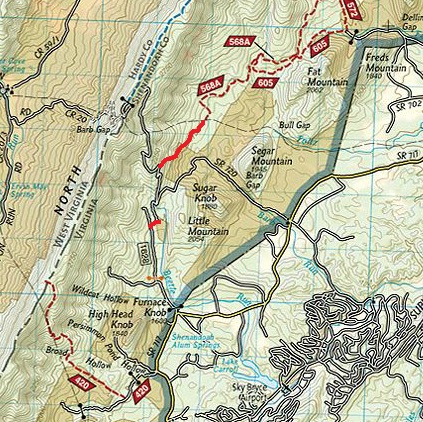
Route Overview: Courtesy of Bill Hazlegrove of the Hazlegrove Agency www.hazlegroveagency.com
For a high-resolution JPG and an easy printing PDF CLICK HERE

Cue Sheet: (Thank you Mark Smith!)
1. From parking lot at the back of Sherando lake camp ground near upper lake dam, take a right at gate to field.

2. Follow Slacks Run trail all the way up to a right on Torry Ridge.  There will be a couple lefts along the way. If you take either of these by accident, you’ll end up in a parking lot along the Parkway.

3. Ride Torry Ridge ~4.5 miles then descend taking a left (~9.7 miles into the ride).  Very steep and narrow here.  At the bottom of the descent there is a no-name trail to the right, stay left through a dry creek with a steep climb out.  Fun little section with some small jumps.

Bailout option: If you take a right at the top to “Torry Furnace”, you can take the paved road route 664 back to Sherando lake. 
4. After crossing a small creek, take a left in the “vehicle turn around” onto Mill Creek / Turkey Pen Ridge.  Follow this trail all the way to the top of the mountain.  The local challenge is to make the switch back climb all the way up without stopping or clicking out of your pedals. The last 100 yards to the camp spot are the hardest.  Good luck.

Bailout option: turn left onto jeep road and follow direction from line 7 below
5. Turn right and follow the jeep road for ~3-3.5 miles and turn right onto Kennedy Ridge trail.  This trail starts out with some fun rock sections then a fast descent to the coal road.

Bailout option: Turn right and follow coal road all the way back to route 664
6. Turn left on the coal road.  After ~3 miles yield left onto jeep road.  You will climb for ~5-5.5 miles on the jeep road (stay on switch backs).  You will pass by the Kennedy Ridge trail head again in the opposite direction.

7. Just past the camping spot at the top of Mill Creek / Turkey Pen Ridge trail on the jeep road, you will yield left off the main jeep road.  Less than a couple hundred yards up this dirt road, turn left on Torry Ridge trail.  Along this section of Torry Ridge is a very challenging rock section.  Please be careful!

Just over a mile down Torry Ridge, take a left back onto Slacks Run.  Follow this back to car.

Route Details:
Miles 0 to 7:
Miles 7 to 14:
Miles 13 to 20:
Miles 20 to 31:
Miles 31 to End:

Friday, September 20, 2013

Design the Virginia Endurance Series Logo & get a FREE wool, long-sleeve, Virginia Endurance Series Cycling Jersey!

With fall here and winter approaching we've been talking about creating a group order for long-sleeve Virginia Endurance Series wool cycling jerseys!

One of the companies we're considering is Oregon Cyclewear http://www.oregoncyclewear.com

Oregon Cyclewear Jersey Sample
If our order is for 15+ jerseys the price per jersey will be a measly $58 + $1 embroidery + shipping. Check out their website to view all the options and pricing.

Jerseys will be sold at cost - no markup at all.

The Virginia Endurance Series is, and always will be, FREE. It's all about epic adventure backcountry riding that you only need to get yourself and your bike to a VES event start to enjoy. Think of Virginia's National Forests as your sponsor, and hopefully a jersey like this will help you enjoy the forests more often and more comfortably.

So, if you want a great long sleeve 100% Australian merino wool Virginia Endurance Series jersey, you only pay the cost of the jersey, OR if you create the Virginia Endurance Series logo / design that's selected you'll get a FREE jersey!

Yes, we need a logo for the jersey, so if anyone's willing to create a logo or a design for the jersey that would be super appreciated - and if your logo design is selected - you will receive a FREE long-sleeve wool jersey with the logo you created on it.

Send ideas, sketches, designs to robertissem@gmail.com.

Once we've selected a design we'll post it here along with a firm pricing quote from Oregon Cyclewear (or whoever we decide to go with) and we'll start taking orders!

Here's a few jersey sample images from Oregon Cyclewear:


Thursday, September 5, 2013

9.15.13 Great North Mountain | FREE Event #7 in Virginia's Mountain Biking Endurance Series

(2014 Date = 9.14.2014) What is the Virginia Endurance Series?

2013 GNM VES - Pictures LINK


Great North Mountain is a gorgeous northern stretch of the Virginia Mountain Bike Trail.

Virginia Mountain Bike Trail from Adventure Seen on Vimeo.

Ride Start Time = 9am
Map of & Directions to Ride Start: http://goo.gl/maps/GFiwS
Ride Start Coordinates: 38.759543,-78.841171

This VES event will have 2 length options:
  • GNM route which is a 4-6 hour ride (after climbing 568 turn left onto Great North Mt 1009 - see map below), and ...
  • GNM + Trout Pond, Figure 8, 55 mile route (adds Thorny Bottom Rd and the Long Mountain Trail / 1007). 
Both options guarantee 9.15.13 will be an absolutely incredible day on the mountain bike.
The overlook above Trout Pond.
A view from the Great North Mountain ridge.
GNM ride starts at Tomahawk Pond, just:
  • 15 miles west of Mt. Jackson, VA - Exit 273 on I81
  • 25m Northwest of Harrisonburg
  • 1h30m from Charlottesville
  • 2h from Washington DC and Frederick, MD
  • 2h15m from Roanoke
  • 2h30m from Richmond
Navigating the Routes:
All trails (EXCEPT the two drawn in red trails in the image below) are easily visible on National Geographic Trails Illustrated Map #792 (click here to buy map #792):
The 2 drawn-in RED trails above are not on map #792 - please make note of them!
Course Map Download Link: https://www.dropbox.com/s/9hugkxr3b61dvy3/great-north-mt.jpg

Cue Sheet: Thank you Kyle Lawrence!

Parking: Tomahawk Pond on the east side of State Route 610. About 5 miles south of Basye on 610

  • Head north on 610 for 5 miles to Basye
  • Left turn onto SR 717 (Travel roughly 1.5 miles)
  • Left turn onto Forest Road 1628
  • Stay right on the road until it ends then you will continue north on a short piece of trail
  • Trail ends up on SR 720 (Crooked Run Rd)
  • Left on Crooked Run and start looking for blaze on north side of road at a switchback (Less than a 1/2 mile up) 
  • Follow the road (568A) past a handful of recent timber cuts until it turns to route 252 and around the gate
  • You will pass two trails Falls Ridge (572) and Stack Rock (568B)
  • Careful not to miss the turn for Laurel Run (568) it comes at a sharp bend in the road and will be on your left. Oftentimes, hikers park cars here and obstruct the gate/trail head
  • Climb Laurel Run. At the top you can either choose the bonus loop dropping down to Trout Pond or begin your journey on the ridge of Great North Mountain (Trail #1009)
    • (Optional) Trout Pond Directions: At the top of Laurel run, turn right onto 691 and look for a left onto 1007 (Marked with hiking sign)
      • Drop down a fun descent and either take the Long Mountain Trail or shortcut it! and turn left to follow trails Trout Pond/Rockcliff Lake
      • The climb out of Trout Pond can be found at the top of the campground and near one of the sites. You will climb past the well and follow the road all the way back up to the North Mountain Trail.
  • If you continue on Great North mountain you will have over 6 miles of beautiful ridge trail with a few incredible views. Make sure to REMAIN on 1009. The the intersection of Falls Ridge and Stack Rock can be tricky. You should never plummet steeply off the ride. before you reach the top of Crooked Run road.
  • At the top of Crooked Run road, go around the tower and pick up the trail on the other side (not on the map)
  • Continue on the ridge past Trail #420 (good bailout option) which will be marked with a hiking sign
  • Follow the ridge all the way back to Trail #421 (Hunkerson Gap)
Raw GPX File: https://www.dropbox.com/s/rzm3s0f3soqvjfi/GNM53.gpx Note: I drew this route with the National Geographic Trails Illustrated Explorer Software, it is not an actual ride GPX route, so the trail and waypoint locations will all be approximate.)

GPX File (Courtesy of Zack. Trail locations are approximate):


Overview Maps:


More Detail:


NOTE: Ride Start / Tomahawk Pond is at route mile 27.95 on this map.
September = Epic Ride Month: As a result of this date selection, I am pleased to announce that IMBA has officially declared September to be "Epic Ride Month". So please take all the fitness you earn over the summer, bring it to Virginia in September, and get your self to the start of the 9/2 15th Annual Shenandoah Mountain 100, then this 9/15 Great North Mountain VES event, and ... what could be a better grand finale to a month of epic riding than the 9/29 Jeremiah Bishop Alpine Loop Gran Fondo!